


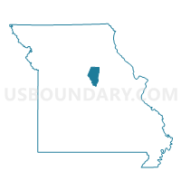
Voting District 6E, Boone County, Missouri
About
Outline

Summary
| Unique Area Identifier | 607220 |
| Name | Voting District 6E |
| County | Boone County |
| State | Missouri |
| Area (square miles) | 0.67 |
| Land Area (square miles) | 0.66 |
| Water Area (square miles) | 0.00 |
| % of Land Area | 99.57 |
| % of Water Area | 0.43 |
| Latitude of the Internal Point | 38.91048470 |
| Longtitude of the Internal Point | -92.31042180 |
Maps


Graphs
Select a template below for downloading or customizing gragh for Voting District 6E, Boone County, Missouri


Neighbors
Neighoring Voting District (by Name) Neighboring Voting District on the Map
- Voting District 28, Boone County, MO
- Voting District 6D, Boone County, MO
- Voting District 6G, Boone County, MO
- Voting District 6I, Boone County, MO